Logo CImaGeo
emphasis

Welcome to CImaGeo

Central de Imageamento Geofísico

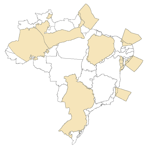
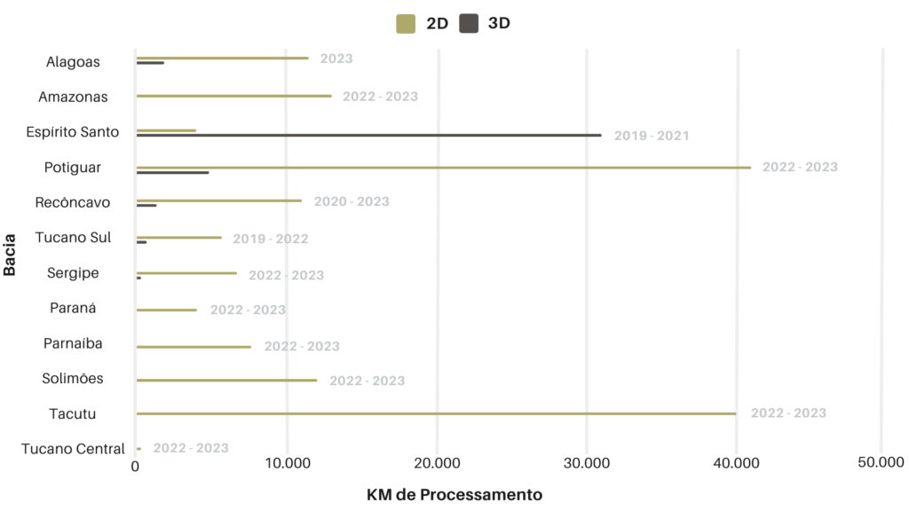
Operating since 2013 in onshore/offshore 2D and 3D reflexive Seismic Data Processing company specialized in the prospecting, exploration and production development of petroleum and natural gas fields on land or at sea.

Over 60,000 km of 2D lines processed

Processed 2D lines in the basins: Alagoas, Amazonas, Espírito Santo, Paraná, Parnaíba, Potiguar, Recôncavo, Sergipe, Solimões, Tacutu, Central Tucano, and Southern Tucano.

Over 10,000 km² of 3D data processed

Processed 3D data in the basins: Alagoas, Espírito Santo, Potiguar, Recôncavo, Sergipe and Tucano.

Mapa das bacias com dados processados.

In the graph below, our processing history of 2D lines and 3D data in the basins is shown by mileage.

History

The company CImaGeo was created to meet the demand for companies capable of processing seismic data in small volumes and low processing costs, which are not of great interest to larger companies that provide this type of service, especially in the case of onshore data.

Mission

The company CImaGeo is an onshore/offshore 2D and 3D reflexive seismic data processing company. Even though our headquarters is in Brazil, our operations are not limited to the data processing of Brazilian basins only. We process seismic data from any country in the world.

Principles

We at CImaGeo rely on our guiding principles to achieve our mission as promised: team work. We have created a work environment that fosters teamwork and cooperation, treating each other with respect and understanding.

en_US